
How Spexi Helps Insurance Firms Innovate
From underwriting to catastrophe response, policy reviews to claims validation Spexi gives insurers the up-to-date visuals they need to reduce risk, resolve faster, and protect margins.
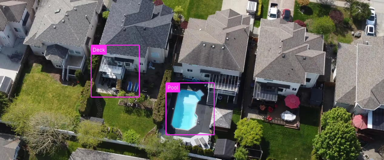
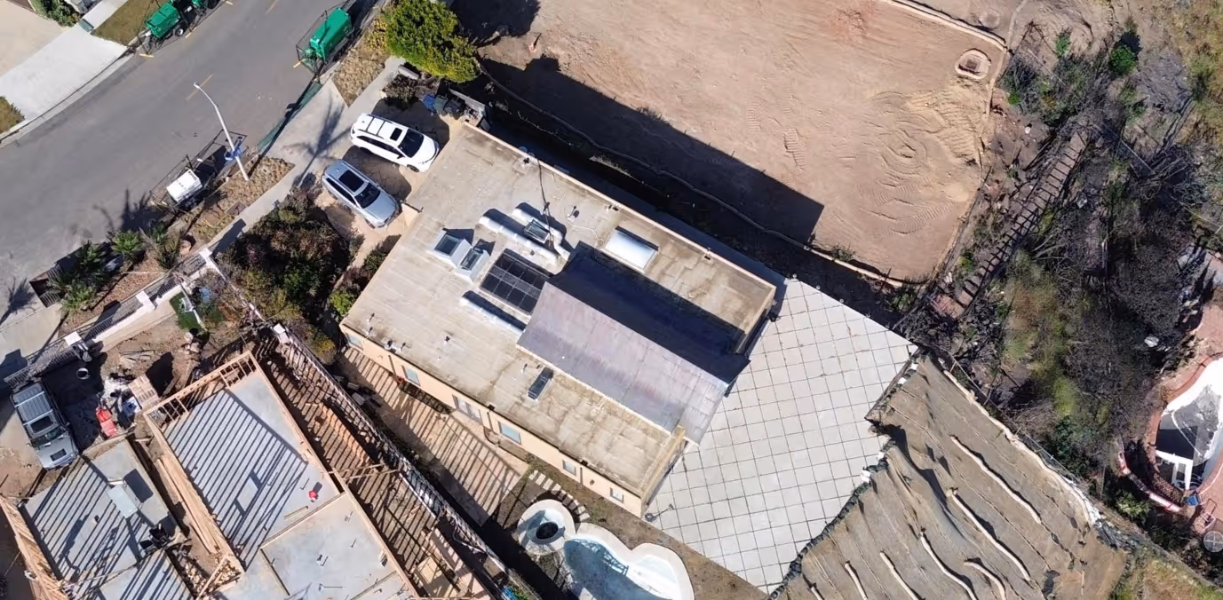
Underwriting & Risk Assessment
Inspect properties without human error using high-res drone imagery. Eliminate outdated data and identify roof damage, fire risk, or flood exposure before bind time.
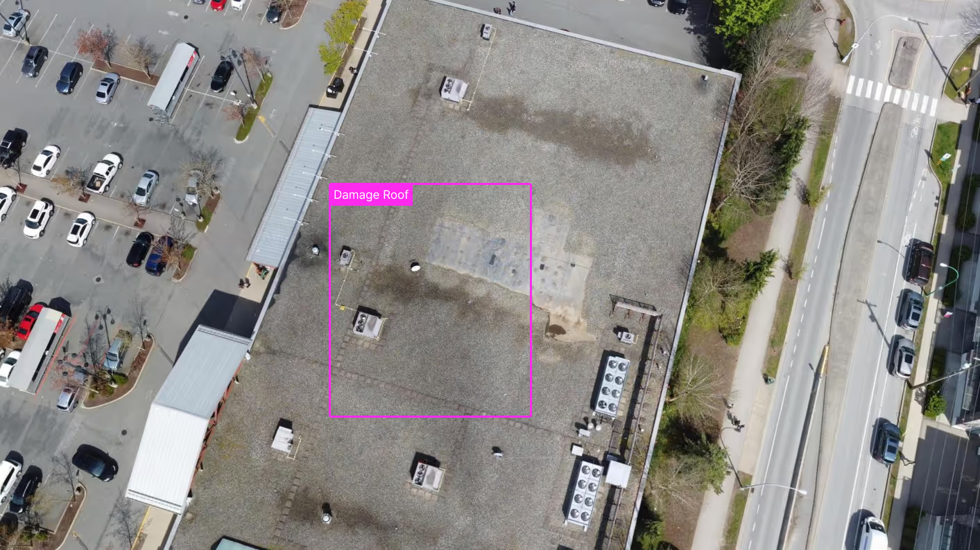
Policy Servicing & Renewal Reviews
Track changes in property condition with up-to-date aerial imagery. Catch roof decay, unreported additions, or risk creep before renewal. Use current aerial visuals to avoid bad data, renewal disputes, or last-minute cancellations.
Claims Processing
Capture post-loss imagery fast to verify damage and prevent fraud. Skip the delays and risks of physical site visits and cut claim resolution time in half.
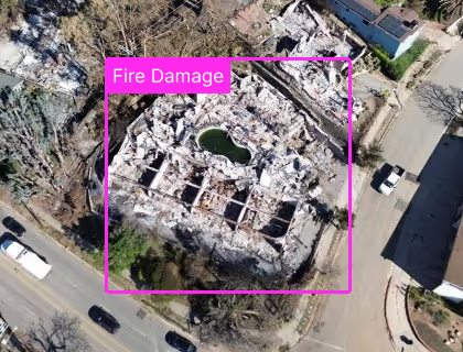
CAT Response & Catastrophe Modelling
Deploy drones immediately after a disaster for real-time impact mapping. Replace slow, expensive flyovers and guesswork with accurate, on-demand data for loss modeling and triage.
Faster Claims. Smarter Underwriting. Lower Costs.
Spexi taps into a network of drone pilots, each equipped to capture fresh aerial imagery. Our platform automates flight planning, data collection, and processing, so you get clear, detailed views on demand.
01. Spot Scans + Wide Coverage
Only pay for the data you need—whether it's a single site, a cluster of claims, or an entire storm path. Spexi makes aerial imagery coverage scalable and cost-effective.

02. Reinvesting in Your Local Economy
Spexi activates local, certified drone pilots—putting your aerial imagery budget back into your community and creating new opportunities where you live.

03. Fresh Data, Whenever You Need It
Request up-to-date aerial imagery as often as needed—so you’re always making decisions based on the most current data available.
Trusted by Insurers, Proven in the Field
Across the industry, Spexi helps insurance teams get high-resolution aerial data up to 200x faster, 50x more affordable, and with far less operational overhead—enabling quicker assessments and better customer outcomes.


For insurance carriers, adjusters, and risk management teams handling claims and underwriting at scale. Our APIs give you fast, flexible access to high-resolution aerial data across your entire book of business.

Technology That Scales With Your Portfolio
Get the aerial imagery you need, when you need it. Spexi delivers high-resolution aerial data in near real-time, enabling faster underwriting, quicker claims validation, and smarter risk decisions—giving insurers the intelligence to act with confidence.

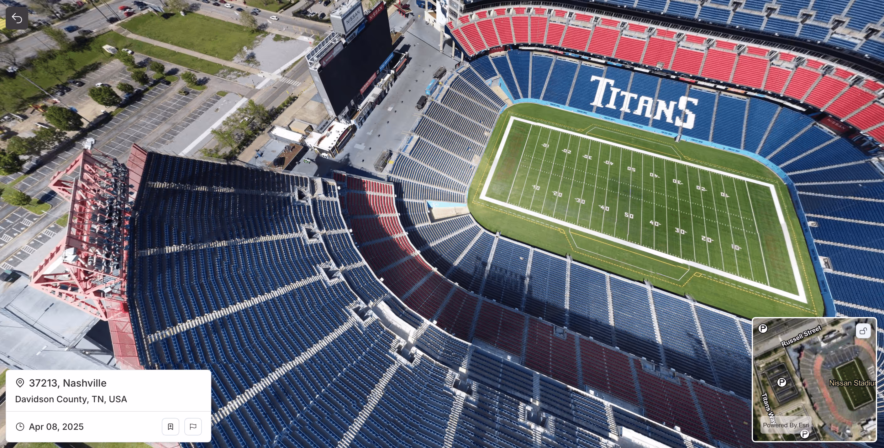
Aerial Data Everyone Can Use, Instantly
Put the latest aerial data in the hands of every stakeholder. Spexi’s browser-based map viewer makes it easy for teams to access, review, and act.

Consistency You Can Trust, Across Every Flight
No matter who flies, standardized flight path and capture methods ensure reliable aerial data that delivers consistent imagery you can compare over time.

Deploy Drone Coverage in Hours, Not Weeks
Whether it's a flood, fire, or infrastructure failure, Spexi enables AEC firms to request and receive up-to-date aerial imagery in hours or days, not weeks.

Built for Speed, Designed for Compliance
Pilots on the Spexi Network operate exclusively with sub-250g drones, allowing them to fly faster and with fewer regulatory hurdles. That means no lengthy approvals, less red tape, and quicker access to the imagery you need.
Smarter Decisions Start With Better Data
