World Viewer Update: Time Series Comparison, Bookmarking, & Enhanced Search
High-resolution aerial imagery is a game-changer for industries that rely on precise, up-to-date visual data—whether it's construction monitoring, urban planning, insurance assessments, or real estate development. With access to on-demand aerial imagery, Spexi users can make faster, smarter decisions with unparalleled aerial insights. With our latest updates, we’re making the user experience even more intuitive and efficient than ever.
This release contains three major updates:
- The new search features enhance customer experience with dynamic queries, pano orientation, and mini-map pins.
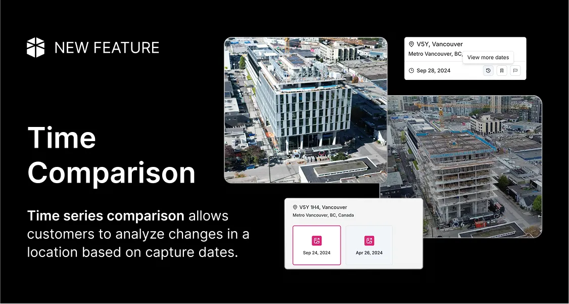
- Time series comparison allows customers to analyze changes in a location based on capture dates.
- Bookmarking functionality provides quick access to saved locations, streamlining navigation and usability.
Search Feature Enhancements

The Spexi World Viewer’s latest search enhancements make finding locations significantly easier. These updates make locating and exploring high-resolution aerial imagery as intuitive as scrolling through your favorite app.
The search bar now lists your 5-6 most recent searches in chronological order. No more retracing your steps or trying to remember that perfect address you explored earlier.
If you're searching for something new, just start typing and a dynamic drop-down populates matching locations in real time. Select one, and the map instantly zooms in, zeroing in on your point of interest.
Here's the best part: Search for a specific address, and the pano automatically orients itself towards your selection and drops a location pin in the mini map for additional wayfinding. No more manual adjustments or guesswork.
Additionally, the general location search (e.g., Vancouver, BC) allows users to explore a broader area rather than a single address. Instead of locking into a predefined spot, the panoramic view provides an overview of the region, enabling customers to navigate different points within the area. This functionality is especially useful for gaining contextual insights into larger developments, neighborhoods, or landscapes.
Time Series Comparison

Time series comparison on the Spexi World Viewer is incredibly useful for anyone who needs to track changes over time. Instead of flipping between multiple capture dates of the same location, you can now view a seamless timeline of imagery, all from one place.
In the panorama, click the"View More Capture Dates" button to access a list of capture dates, formatted by month and year., Just tap a date, and the corresponding imagery instantly loads, giving you a snapshot of that specific moment in time.
For additional context, when you select a location from the default map, it automatically directs you to the most recent imagery.
Plus, the mini-map stays in view, offering a cardinal direction display to keep your spatial bearings intact. It's an effortless way to stay oriented while exploring dynamic changes.
For example: Real estate professionals can show potential buyers the current state of a property along with how it's evolved over time, as detailed in our high-resolution drone imagery insights. Construction progress, seasonal transformations, or neighborhood developments—everything accessible in an instant. This update essentially adds a layer of storytelling & helps close deals.
Bookmark Functionality

The new bookmarking functionality significantly improves navigation within the Spexi World Viewer by allowing customers to save specific points of interest within a panoramic image for future reference.
Here's how it works. In the pano view, you can save two types of bookmarks, either a general location marked by a postal code or a specific address with full details. Once saved, these bookmarks are ready for instant access whenever you need them. No more scrolling, searching, or backtracking.
When you bookmark a specific address , the panoramic image opens perfectly oriented to face the exact location, complete with a visible address marker. When bookmarking a general location , the panoramic image displays the general area, maintaining the default behavior. It's seamless, intuitive, and eliminates the guesswork.
What These Product Enhancements Mean for Spexi Customers
The latest updates to the Spexi World Viewer focus on improving spatial awareness and precision, making it easier to accurately locate points of interest within the Spexi World Viewer.
From the enhanced map navigation to the upgraded search features, every improvement makes your workflow faster and more intuitive. The new time series comparison feature changes how users monitor and analyze changes in infrastructure, land use, and environmental conditions over time. Lastly, the bookmarking functionality makes it easier to save important images and access it instantly anytime in the future.
Try it Today!
Ready to explore the world like never before? Jump into the updated Spexi World Viewer and experience high-resolution aerial imagery in your city. Check out the latest updates and see your surroundings from a whole new perspective.


