
Book a Demo to Explore On-Demand Aerial Imagery
See for yourself how Spexi's high-resolution aerial imagery can streamline your workflow, reduce field visits, and accelerate decision-making.
Thank you for
requesting a demo!

Unlock the Power of On-Demand Aerial Data
Get fast, affordable access to on-demand high-resolution aerial imagery with Spexi. Make faster decisions, improve accuracy, and streamline operations without the wait.

City of Kelowna

How It Works

Aerial Imagery at Scale – 900× more detailed than satellites, 200× faster than fixed-wing aircraft, and 50× more affordable than traditional methods.
Sub-250g Drone Operations – The Spexi network utilizes ultra-light drones to image cities safely, efficiently, and in full compliance with airspace regulations.
97% Fewer Emissions – Compared to fixed-wing surveys, Spexi delivers aerial data with a dramatically smaller carbon footprint.
Use Cases
High Resolution Drone Imagery At Work
Infrastructure Inspection
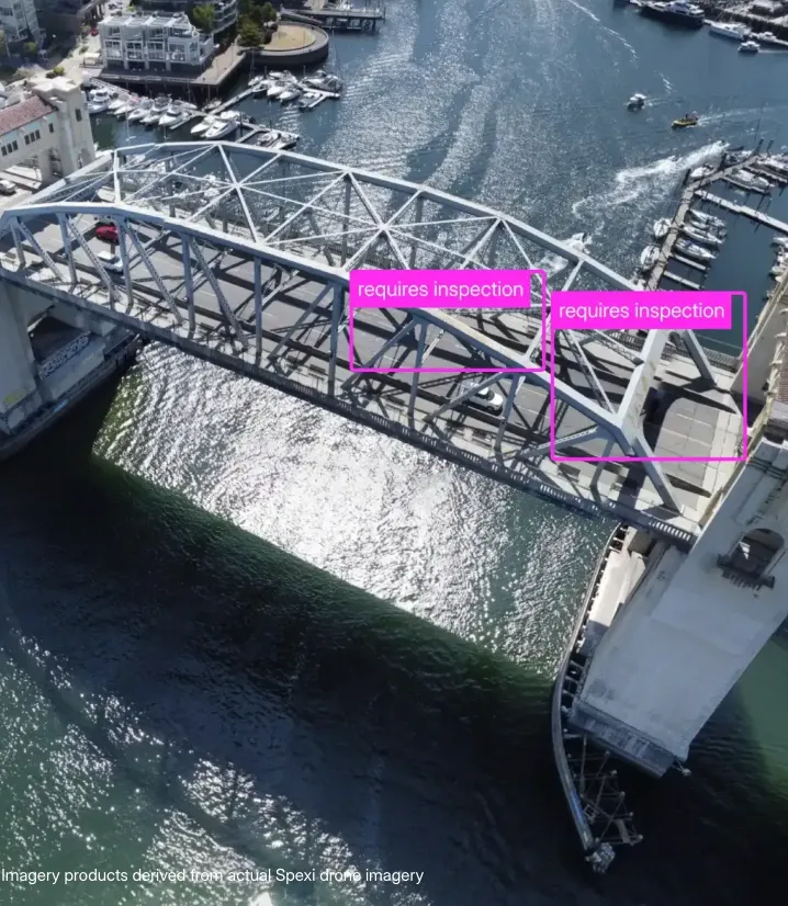
Monitor railways, bridges, and roads remotely with ultra-high-resolution imagery. Keep critical infrastructure safe, efficient, and operational.
Augmented Reality + AI
Power AR, VR, AI, and real-world gaming with fresh, ultra-detailed imagery. Build immersive, accurate digital environments with confidence.
Smart Cities

Fuel self-driving cars, last-mile delivery, city permitting, vegetation control, and more with frequently updated aerial imagery for smarter urban planning.
Our Features
Access the World’s Most Updated Imagery

AI & Computer Vision
Unlock next-level insights with ultra-high-resolution aerial imagery, fueling AI models, automation, and computer vision applications.

Effortless Collaboration
Share imagery with stakeholders instantly using our built-in viewer, no extra setup required.

The Most Detailed Earth Imagery Ever
Drones capture imagery 900x more detailed than satellites, delivering crystal-clear aerial views.

Access the Freshest Data
Access recently captured aerial imagery whenever you need it, ensuring data-driven decisions based on the latest insights.

Eliminate Unnecessary Site Visits
View the latest high resolution imagery from your desk and make faster decisions without sending teams on-site.

Seamless Esri Integration
Easily integrate, analyze, and customize aerial imagery within your existing Esri and GIS workflows.
